Salt Spring Island
We had planned to spend the Canada Day long weekend in Vancouver to visit a few friends, but all of them were going to be out of town. Luckily, three were going camping together and invited us along. The site for the weekend’s festivities was Ruckle Provincial Park on Salt Spring Island. While we weren’t heading to the mainland yet, we were finally saying goodbye to Vancouver Island after almost a month.
Salt Spring is one of the most popular and populated islands between Vancouver Island and the mainland, but the Park where we were camping was on the very tip and fairly isolated. To get to the campsites, you have to park and then use one of the wheelbarrows supplied by the Park to walk your equipment into a site. While we were used to backpacking stuff in, the barrows helped make the process that much easier (especially since Amalia’s foot was still on the mend).
When we arrived on Wednesday the Park was already pretty full but we were able to grab a couple of sites right on the ocean. The views from the site were amazing as we could look out onto the ocean and see many other islands (including the Washington ones). We were also right on the main ferry path from Tsawwassen (near Vancouver) to Swartz Bay (near Victoria). While we were a little apprehensive at first, watching the giant ships cruise by (especially at night where they were lit up like chandeliers) proved to be a highlight of the weekend.
We spent several wonderful days on Salt Spring. The weather was amazing, we got to work on our tans, the group of friends was great fun (there were 10 of us in all), and we had a very relaxing time.
Vancouver
After the long weekend we headed to Vancouver for a few days. Although we were staying out in New Westminster (thanks Mike and Kate!), we had easy access to downtown via the SkyTrain.
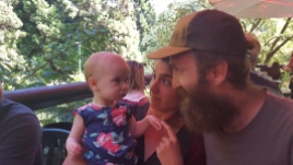
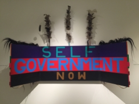
We spent a bit of time and had lunch in Stanley Park with Ben’s cousins Cameron and Heather (and baby Brianna who seemed skeptical of Ben’s beard). At the recommendation of several people, we visited the Museum of Anthropology at the University of British Columbia where we admired the many Indigenous artifacts and artwork, especially the special exhibit “Unceded Territories” by artist Lawrence Paul Yuxweluptun. His work was bright, colourful, and politically provocative (in the good way).
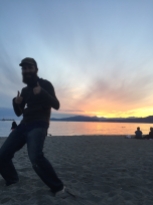
We had many delicious meals in the city including vegetarian Dim Sum at Po Kong, mind-blowing vegan chicken wings and other delicious food at Meet on Main, an unbelievably filling breakfast at Bandidas Taqueria (must go back), a little bit of Cypriot flavour at Takis’ Taverna (Amalia’s dad’s name), and then a magical sunset beach BBQ (thanks Ian and Victoria!).
Bonus: Minit-Tune & Brake Auto Centre (for happily reassuring us that the liquid we found dripping from the van’s engine was just condensation and for not charging us for the diagnosis), the mushroom gravy at the Stanley’s Bar & Grill (amazing), the beer at 33 Acres Brewery, drinks with friends at The Black Frog, Aperture Coffee, Turks Coffee, Baaad Anna’s knitting store.
Northern British Columbia
After our time in Vancouver, it was time to head North. Our next destination was Whitehorse in the Yukon, but the drive is a long one from Vancouver – 28 hours. Instead of pushing ourselves too hard, we decided to take our time and do the trip in 8 days.
We past Bridal Veil Falls on the way out of town (Ben remembers them from when he was a kid), but while we appreciated them from a distance, Amalia’s foot was still sore and she was only up for one hike that day which is why we stopped instead at Coquihalla Canyon Provincial Park to see the Othello Tunnels. The former site of a railway through the mountains, a series of tunnels and trestles now form a short but impressive hike through a canyon. It was very cool.
From Coquihalla Canyon we headed north to Lillooet following the Fraser River. The final part of the drive on the Lytton-Lillooet Highway (12) was quite an adventure. A lot of the highway runs alongside a fairly deep drop-off and their are winding stretches that are gravel and just a single lane (where you can’t really see if someone is coming in the other direction … luckily no one was). A hilarious sign on the way in and out of Lillooet stated the following wise words: “If at first you don’t succeed, skydiving isn’t for you” and “Small town ahead, don’t believe anything you hear”. That night we stopped at the Seton Lake Campground which is provided for free by BC Hydro.
The next day we stopped at Horstings Farmers Market for supplies, Chasm Provincial Park for a pretty cool view of a canyon carved by a glacial river 10,000 years ago (thanks for the recommendations Tracy and Bobby), and then continued north to an beautiful free campsite on Chubb Lake. British Columbia has a whole network of primitive, free campsites, with extremely clean pit toilets, and we planned to take full advantage. Every day of our drive it rained for at least part of the day, and on this evening we were treated to a major thunderstorm – in the distance, and then up close. Up until this point, our encounters with mosquitos had been few and far between. Unfortunately for Amalia (who they love), that was about to change. During most of our camp-outs between Chubb Lake and Whitehorse we had lots of little hungry friends in the form of mosquitos and black flies that were eager to say hello. Within hours Amalia was swollen and itchy in many places. Ben was annoyingly less appetizing.
On Saturday we got up in the pouring rain and headed to Prince George for coffee. As it turned out, that weekend was Pride weekend in Prince George, so we got to see the Prince George Pride March which was pretty great and happened to occur while it wasn’t raining. As we headed out of town we found ourselves driving through a torrential downpour of carwash intensity – definitely the hardest it had rained since Florida. As we continued on, we passed lake after beautiful lake, gorgeous green forests, happy deer, and cuddly black bears. We spent the evening at another beautiful free campsite on Kager Lake. We drank wine and read on the dock while watching a pair of beavers collect wood for their house.
It was pouring rain again the next morning as we headed west (the route to the Yukon is anything but direct). The day saw us enter some pretty awesome mountains and leave the main highway that connects Prince George to Prince Rupert. Taking Highway 37 north, signs of civilization (and mobile reception) disappeared. We were really in the middle of nowhere. We drove further into the coastal mountains as we took a detour towards a small town called Stewart. The stop had been recommended to us by our friend Laura and wow, was it ever spectacular. The drive itself was worth the trip as we navigated down a winding mountain canyon towards Stewart (which is at the head of the 114 km long fjord). The highway provided lots of wildlife spotting as well as the sudden appearance of Bear Glacier emptying into a road-side lake. It was the first glacier Amalia had ever seen, and as we looked around we realized we were surrounded by them. Everywhere we could see their presence, either as caps of ice majestically settled into mountain valleys, or the hundreds of waterfalls cascading down from all sides. We spent the night at yet another free campsite on Clements Lake with the sound of a glacial waterfall thundering in the distance
We woke up to a cloudy morning and headed into Stewart. The town is quite quaint and is home to an international port where large windmill segments are loaded onto trucks for wind farms being built inland. It is also home to the only border crossing from Canada into the United States that does not have US border guards. So we drove right in (it’s allowed). After observing a lonely male salmon waiting for someone to spawn with, we headed up into the mountains on a long dirt road that led back into Canada and up to the Salmon Glacier, one of the largest in North America. The view was spectacular! We had planned to head further north that day, but apparently there had been a major accident further on up the highway, so it was closed for hundreds of kilometers in both directions (because there are no other routes). We stopped at a nearby Provincial Park and spent another night camped at Meziadin Lake Provincial Park on yet another beautiful lake.
We spent most of the next day driving as we had to make up time and stopped only for the necessities. Thanks to an RV in front of us, we slowed down and caught site of a beautiful red fox chowing down on some grass at the side of the road. While we had another free, river-side campsite lined up for the night, we first stopped at Boya Lake Provincial Park on the way just to check out the spectacular crystal blue water. Should have stayed and swam, but we were tired and just wanted to stop driving for the day.
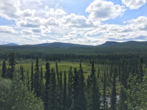
With a much lighter day of driving, and some spectacular forest and former forest (forest fires) scenery, we stopped several times for photos. The landscape up here is so different. We crossed into the Yukon, stopped at the Rancheria Falls, and then crossed back into BC (cause that’s where the highway goes), and camped at our final free campsite of the journey on Morley Lake. This one was really beautiful. It was on a long sandy beach and arctic terns were wheeling through the air and diving to catch both insects and fish.
We spent the next day driving beside some spectacular mountains as we made our way to Whitehorse.


